WHAT RIVER CITY CONSULTANTS CAN do for you
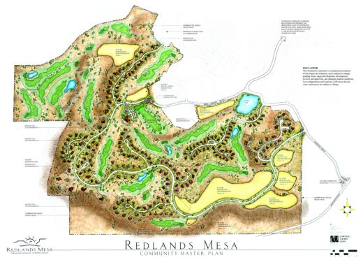
River City Consultant’s principal engineers and surveyors have over 100 years of combined consulting experience in a broad range of service capabilities and have built solid relationships within our community. We provide land development and municipal design, water resources, wetland delineations and permitting, environmental engineering and stormwater management, land surveying, utility location services, project coordination and management, client representation, municipal process facilitation, construction observation services, and associated support services.
We work as a team to provide our clients with quality service second to none. Our goal is to guide our clients through the project process from initial project conception to successful completion, every time. Find out more about each of the services we offer by browsing this section of our website.
- Master Planning
- Infrastructure Design (Streets and Roads, Water/Wastewater, Grading and Drainage)
- Hydrologic and Hydraulic Modeling and Analysis
- Site Planning
- Commercial Site Design
- Residential Site Design
- Stormwater Modeling, Design, and Permitting
- Construction Services (Construction Management, Surveying, Observation, etc.)
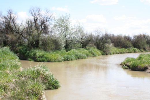
Named for the Colorado River that has created and defines the community we live in, the staff at River City Consultants is environmentally aware and truly cares about preserving our surroundings. Through innovative and insightful design techniques, we offer water resources professionals with years of proven experience that are able to meet project goals while maintaining a standard of environmental sensitivity. Services include:
- Hydrologic and Hydraulic Modeling and Analysis
- Basin Studies
- Floodplain Mapping
- Watershed Analysis and Planning
- Water Systems Analysis and Design
- Water/Wastewater Facility Infrastructure Design
- Water Distribution Systems Design
- Drainage and Grading Plans
With two in-house Certified Floodplain Managers and an in-house specialist who has earned both of the prestigious Certified Professional recognitions in Erosion and Sediment Control (CPESC) and in Storm Water Quality (CPSWQ) by the internationally-recognized EnviroCert International program, River City Consultants is well-qualified to provide environmental and stormwater management services to complete your project needs, including:
- Phase I Environmental Site Assessments
- Spill Prevention, Control, and Countermeasure (SPCC) Plans
- Stormwater Pollution Prevention Plan (SWPPP) Design
- National Pollutant Discharge Elimination System (NPDES) Permitting
- Stormwater Modeling, Permitting, and AnalysisStormwater Management Plans (SWMP) Design and Inspection
- CDOT-Certified Inspections
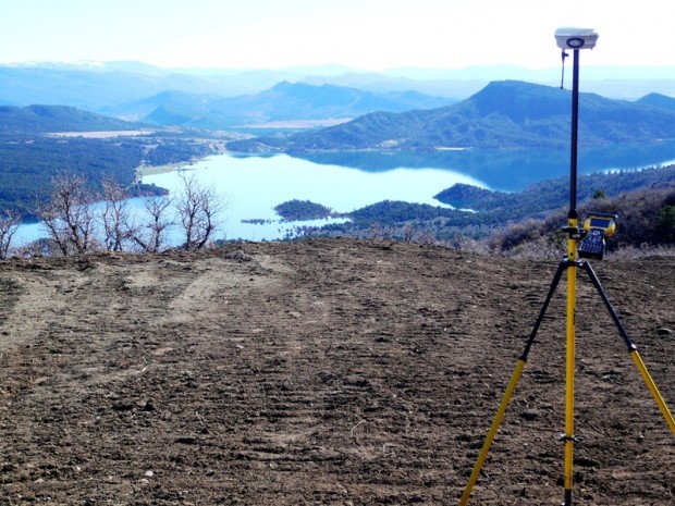
We have completed thousands of land surveying projects, and use state-of-the-art technology including the most current versions of AutoCAD Civil 3D and GPS/GIS equipment and software to ensure our clients with only the highest-quality and most complete and accurate information possible.
We firmly believe in the importance of precise and accurate survey control data. Our in-house surveying team is experienced in design and control surveys and is familiar with Mesa County’s GPS infrastructure and local coordinate system. Our field crews are trained to evaluate existing features and anticipate the needs of the designers when collecting data for design surveys. With the exception of some data collected for post-processing, GPS and RTS observations are all collected and processed electronically, greatly enhancing the accuracy of our data. Our control program is based on establishing survey control points accurate and durable enough to last throughout the duration of the construction process.
We currently have two Professional Land Surveyors on staff, in addition to CAD designers and survey crews. Surveying services include:
- Boundary/Cadastral Surveys
- GPS Control Surveys
- Topographic Surveys
- Floodplain Certificates
- ALTA/ACSM Land Title Surveys
- FEMA Elevation Certificates
- Easement Surveys and Description
- Subsidence Surveying and Monitoring
- Location Surveys
- Geodetic Control Surveys
- Aerial Mapping Surveys
- Pipeline Surveys
- Construction Staking for projects including but not limited to; Residential Subdivisions, Commercial Developments, Industrial Projects, Highways and Structures, Airports, Oil and Gas Sites, etc.
In March 2011, River City Consultants expanded its scope of services by acquiring American Utility Specialists, Inc. (AUS) from Cliff Schroder. AUS has been providing utility locating services for construction and engineering projects throughout Western Colorado for nearly 28 years and maintains a superior reputation for providing reliable services as a separate entity.
Clients experience business as usual with AUS, with no change in the timely response and accurate locates they have come to expect. As a division of River City Consultants, AUS continues to have responsibility for the field operations of their projects, complete the bulk of the local utility locates, and provide excellent utility location services including:
- Expertise in Engineering Design Locates
- Prompt Attention to Emergency Locates
- Availability for After-Hours Locates
- Out-of-Town Locating Services
Locate Specialists with Extensive Knowledge and Familiarity of Western Colorado
To order locates you may call our office at 970.241.4722.
From managing team communication to maintaining detailed project schedules, our commitment to provide quality service paired with our project coordination services allows us to provide our clients with an exceptional project management experience throughout the development of the project, from initial project conception through the planning process to the final stages of successful project completion. We have worked with and developed personal relationships with officials from many local, state, and federal agencies, utilities, and special districts. In addition, we are familiar with and have long-standing relationships with local key firm project participants necessary to ensure our clients with a full-project experience throughout all phases of the project, from preliminary investigations to successful project completion. Services include:
- Site Assessment
- Client Representation
- Municipal Process Facilitation
- Outside Consultant Coordination
- Utility Provider Coordination
- Construction Observation
- Use Actions, including but not limited to; Site Plan Applications, Annexation Applications, Preliminary and Final Plats, Major/Minor Subdivisions, Rezone Applications, Conditional Use Permits, Growth Plan Amendments, etc.
In addition to general civil engineering and land surveying services, River City Consultants also provides a diverse range of support services for the various aspects of energy and mining industries from development to transport. We have completed numerous energy and mining support services projects throughout Western Colorado and the Piceance Basin, and have an extensive resume of oil, gas, and mineral resources clients for whom we have provided a variety of services.
We are familiar and compliant with stringent safety programs common to the industry and are members of safety and monitoring programs including PEC Safety, IS Networld, and DISA. In addition, we regularly follow the Bureau of Land Management’s Surface Operating Standards and Guidelines for Oil and Gas Exploration and Development: The Gold Book and other standards. In fact, recent study we completed of private oil and gas access roadways in a nearby county were so thorough and complete, the county has decided to use our report as the gold standard for assessment of future submittals for similar county roadways in an effort to ensure all are within policy compliance (read more about this).
River City Consultants uses state-of-the-art technology including the most current versions of AutoCAD Civil 3D and GPS/GIS equipment and software to ensure our clients with high-quality and complete and accurate information. We currently have two Professional Land Surveyors on staff, in addition to CAD designers and survey crews. Our surveying staff is experienced in design and control surveys and is familiar with Mesa County’s GPS infrastructure and local coordinate system. Our field crews are trained to evaluate existing features and anticipate the needs of the designers when collecting data for design surveys. With the exception of some data collected for post-processing, GPS and RTS observations are all collected and processed electronically, greatly enhancing the accuracy of our data.
In addition, we are familiar with and have long-standing relationships with local key firm project participants for energy-related projects necessary to provide services such as geotechnical investigations to ensure our clients with a full-project experience throughout all phases of the project, from preliminary investigations to successful project completion.
Below is a sampling of the many services we are able to provide:
Engineering
- Drainage and Surface Grading Plans
- Pad/Staging Area Site Design/Layout and Grading
- Roadway and Access Design
- Federal, State, and Local Permitting
- Erosion and Sediment Control
- Stormwater Quality and Management
- Stormwater Treatment Plans for Well Pads, Pipelines, Roadways, and Other Linear Projects
- GeoComposite Liner System Design
- Pipeline Design
- Pond Design and Lining
- Compressor Station Design
- Water Treatment Plant Design
Surveying
- Construction Staking – Roads, Well Pads, Compressor Stations, Tank Sites
- Location Surveys – Compressor Stations, Piping, Instrumentation Diagrams
- Geodetic Control Surveys
- Aerial Mapping Surveys
- Pipeline Surveys
- Well Location Surveys
- Subsidence Surveying and Monitoring
- ALTA/ACSM Land Title Surveys
- Boundary/Cadastral Surveys
- GPS Control Surveys
- Topographic Surveys
- Floodplain Certificates
- FEMA Elevation Certificates
- Easement Surveys and Descriptions
Very informative, easy to work with!
We recently had the pleasure of working with River City consultants on a high profile multifaceted million dollar project in Garfield County. The timeline was extremely tight and the work complicated. River City rose to the occasion got the subs in line and finished the project ahead of schedule and under budget. As all project go there were some surprises and changes, River City brought solutions. They are very professional and friendly. I hope we get the opportunity to work with them in the future.
River City Consultants are the best engineering and land surveying company I have ever worked with. Not only did they help us with our Grand Junction location, they came to Denver as well and completed all the work we needed done far in advance. The are professional and very versed in their fields. I would recommend them to anyone
